We are visiting relatives in Harper, TX for Thanksgiving, so we planned a central Texas trip to four Texas parks over a nine-day period. We departed on Thursday, Nov 16th and headed to Dinosaur Valley State Park for one night. The first afternoon we waded in the Paluxy River to view some of the many large dinosaur tracks in the park. We saw a baby bobcat hunting a bird near our camp site just before sunset. The next morning, we did a few miles of hiking in the hills above the river and along a small, clear creek - and we were the only hikers out there.
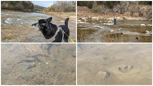 |
Dinosaur Valley SP
|
 |
Dinosaur Valley hiking
|
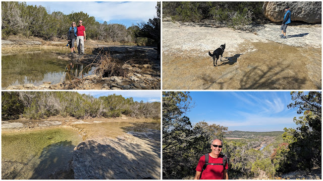
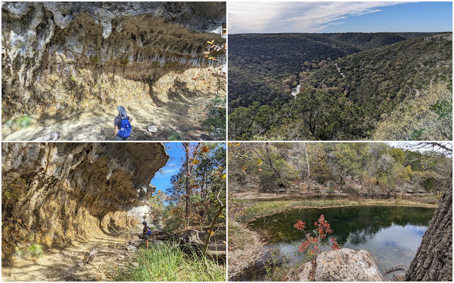
The second night was spent at Inks Lake State Park. We hiked to the Devil's Waterhole and along the Devil's Backbone Trail in the evening, then we hiked on the Lake Trail the next morning. The pink and gray granite is really striking in some sections, and we even got a little taste of fall color in a few areas.
 |
Devil's Waterhole and Backbone at Inks Lake SP
|
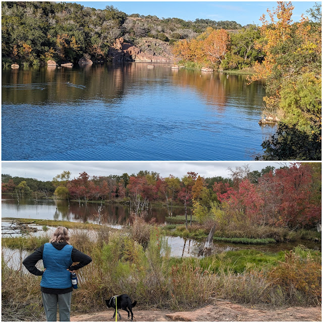 |
A touch of fall color at Inks Lake SP
|
The next two nights were at Garner State Park. We arrived and walked along the Frio River, then hiked up to Crystal Cave, which is a very small cave - but Elena still had to climb in it. The trails here are often steep with loose gravel, so it was often slow-going - and going down with great caution to keep it as a controlled descent.
The second day started with drizzle and fog, and the clouds didn't lift much during the day. We walked along the river a bit in the late morning. We waited until mid-afternoon and hiked up to Old Baldy. Again, it was a steep trail, and the moisture made it quite slippery. We took a long route back after the summit and visited another small cave.
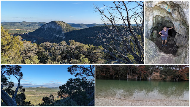 |
Hike up to Crystal Cave at Garner SP
|
 |
Hike along the Frio River in Garner SP
|
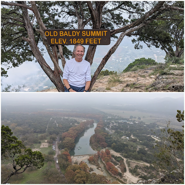 |
On top of Old Baldy at Garner SP
|
Our final park was Lost Maples State Natural Area. This park is in a unique microclimate valley with numerous bigtooth maple trees - which is fairly unusual in Texas. The maple leaves are quite small, which is certainly an adaptation to this hotter climate. The many springs and seeps in the shaded valley areas help the trees survive. These are holdover trees from the last ice age, but the current human caused climate change might finish them off. Many had already dropped leaves in September due to the record heat and drought of the summer. Normally, this week would be peak fall color, but there was only minimal color to be seen.
We hiked two different trails. The East Loop on the first day - about 6 miles and 660 feet of elevation gain. The second day we hiked the west loop for about 6.6 miles and 550 feet of gain. It was a nice hike and some nice limestone terrain, but the maples, and their fall color, might be in long term decline.
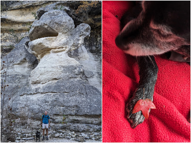 |
At Monkey Rock and Bebop showing a maple leaf.
|
 |
Views from Lost Maples.
|
 |
| A few colorful maple leaves. |
|
|
|
Here are the trip stats:
Trip Duration: 9 days
Miles Driven: 840 miles
Average miles/day: 93
Time Driving: 18 hours
Avg Speed: 47 mph
MPG: 16.5 (vehicle calc); 15.6 (actual)
Gas Used: 54 gallons, average of 6 gallons/day
Gas Cost: $140 ($15/day) - avg of $2.59/gallon
- Paul