Friday, October 21, 2022

Fall Trip Data & Summary

We wrapped up our 35-day fall trip and are home safe and sound. There were many good things on the trip:
- No issues with our Winnebago Travato - all systems performed as designed
- I'm lucky to have such a great travel partner (Elena) as we celebrated our 32nd wedding anniversary during the trip
- I'm also lucky to have the best dog in the world (Bebop) - she is a great companion and traveler
- We had many great adventures and only a couple skinned knees to show for it

On the downside:
- We both got COVID at the start of week #4, after successfully avoiding it for 2 1/2 years. It was likely caught during a grocery store stop - one of our few indoor interactions with people. We just modified our schedule for reduced hiking intensity and kept on rolling.

DATA
Miles Driven: 4,225 miles
Average miles/day: 121

Time Driving: 100 hours

Avg Speed: 41 mph

MPG: 17.1 (vehicle calc); 16.2 (actual)

Gas Used:  257.5 gallons, average of 7.4 gallons/day

Gas Cost: $961 ($27/day) - avg of $3.73/gallon

Campground Cost: $894 (avg $24/day):
(12 state parks, 9 free boondocking, 5 national parks, 5 private campgrounds, 2 tribal campgrounds, 1 city park, and 1 forest service campground)

So many highlights on this trip. We have quite a few blogs posted, but here are a few favorites:
- The Kanarra Falls hike was probably our favorite new adventure. Blog link

The upper falls on Kanarra Creek

- Little Wild Horse Canyon slot canyon hike was right up there in the new adventure ranking. Blog link (by Bebop)

Little Wild Horse Slot Canyon
- We've been to several sections of Antelope Canyon, so we visited a different section - Antelope Canyon X. Blog link (last section).

Antelope Canyon X

- And Canyon de Chelly was interesting - made more so by a fierce rainstorm and flood while we were in the canyon. Blog link.

Spider Rock in Canyon de Chelly

The other blogs, with more photos, are all posted here: https://westbrooktravel.blogspot.com

Favorite photo from the trip - Grand Canyon North Rim

Our Trip Route

We have had our Winnebago Travato for 15 months and have travelled for 141 days and almost 20,000 miles total.

Best,

Paul

Saturday, October 15, 2022

The End of a Long Love Affair . . . Or Not

It was a late September day in 1991 when I first saw her. Her beauty was boundless and I was immediately captivated. I was in town for a jazz festival with my wife, as we were about to celebrate our 1st wedding anniversary with a hike into the Grand Canyon a few days later. But there she was - the town of Sedona, AZ. I couldn’t believe people were allowed to live here - as if people were allowed to live in a national park. The layers of rock color, the green of the juniper trees, the deep blue sky, and the trickle of Oak Creek. I was captivated.

I thought about the town many times, and we came through on vacation a time or two over the years. In 2009, I began to think about possible future retirement locations. The Sedona prices had gone nuts in 2007 and 2008, but the real estate market crash was starting to bring prices back down to reasonable levels. I booked a flight and came out to look around. We would come out twice a year for the next decade and hike the many trails and look at land parcels. I made offers on a few over the years, and several times my offers were accepted. Each time, I would find something during the discovery phase that caused me to back out. It had to be the perfect parcel at the perfect price, and we were in no rush.

I liked that the town was surrounded by national forest, so the growth was bounded. They are a dark sky friendly town. The population is around 10,000 people, and the large number of visitors meant that the town had more grocery stores, restaurants, and entertainment options than most towns of that modest size. The climate was good at about 4,400 feet in elevation - not too hot or too cold. And it was beautiful in every direction I looked.

The more I studied the town and the workings, the more concerned I became. The place seemed to be run by the Chamber of Commerce. Everything was designed to bring more tourists (money), which meant traffic and infrastructure woes. However, the city had a ban on short term rentals to try and make sure it was a town of people who owned, lived there, and were active in the community. Then, in 2016 the Republican led state government passed a law over-ridding the ability for local jurisdictions to regular short term rentals across the state. Sedona started seeing investors pouring in to make a buck. Once quiet neighborhoods now had short term renter traffic. A sense of community was being lost. Then investors started buying lots and building massive houses just to rent out many rooms. Local people who worked there could no longer find a place to live - they have to commute to towns 20 miles away. Greed was destroying the beauty and charm, as seems to be the case so often anymore. 

We made our final trip out in October 2019 and decided another paradise had been lost. I tried to quit dreaming of buying land and building a sustainable home here. I told Elena once that looking at some difficult build lots in Sedona is like looking at a gorgeous woman who you know is going to be nothing but trouble, but not being able to look away for long. Prices started going even crazier during the pandemic and land was flipping in months for double the money - just like during the crazy times of 2007. That helped blunt my enthusiasm a bit.
 
The other challenge is that we have such a nice setup in Fairview, TX. We have 2.2 acres of native woods with our house hidden in the middle. We have some of the kindest, nicest neighbors you could ever want. Not only that, but we have plenty of elbow room on our street, but are only a few miles from almost any amenity you could want. It would be easier to make the move if we lived in a regular old house on a regular old street, or in a decaying area. Our current bar is set very high. 

We hadn’t planned to come to Sedona on our current road trip, but both caching COVID made us scale back on some other big hikes we had planned. Elena suggested we route through Sedona for a couple of days. The things we loved are still there - the rocks, the forest, the creek, the dark skies, the climate. But the trailheads were overloaded with cars and traffic was slow in every direction. We noted, as before, there seems to be a few distinct tourist categories here. One is the nature lovers like us who come, hike, and try to leave no trace. We meet a lot of people out on the trails who are similar - both local people and visitors. There is another group who spends most of their time shopping in the stores and galleries, or eating at the high-end restaurants. There is another trendy group who are out striking the same Instagram pose along every trail and overlook. Then there are the people who come to a quiet, beautiful place and seem to say, “What’s the best way to destroy this?”  They rent the loud ATVs and drive them all over, or jump in one of the many Jeep tours and mark the red rocks black from their tires and belch fumes and noise into the air.

I find myself looking at lots again and dreaming of a little sustainable solar home with great views and easy access to hiking trails. This morning we found three trails that are beautiful, but not very crowded. Bebop really enjoyed hiking, despite the low count of trailside lizards. We drove past some trailheads with over a hundred cars spilling out to park along the roadway. Out on the trails, we remembered all the things we love here. Elena was busy looking up geology on her Rockd app. We noticed that the gem and mineral show was at the Sedona High School, so we dropped Elena off there for a while. On our way back to our campground, it took us about 30 minutes to drive 1.5 miles in the heavy traffic. It’s a town of major pluses and major minuses. It’s fun to dream, but it’s also nice to return home to the wonderful reality we already have. Will we end up here someday? That is unanswerable at this time. Here are a few photos from today before the rain moved in. You would have to try really hard to take a bad photo here.
Up on Doe Mountain

Bebop on Doe Mountain
Paul & Bebop on Doe Mountain
Bebop descending Doe Mountain
At the end of Fay Canyon looking back out
Bebop on the Secret Slickrock Trail
Reflecting in front of Cathedral Rock on the Secret Slickrock
Elena admires the vista

- Paul


Thursday, October 13, 2022

A Week of Catching Up After Catching COVID

One week ago tonight, my lucky streak of 2 1/2 years ran out, and I came down with COVID. We were hiking in the late afternoon and my back was really sore. We got back to the campground and I took a nice hot shower. After I got back to the van, I was still hot - with a fever. A sudden fever and headache, with body aches. We had packed a test, and it showed positive for COVID. One of the things we like about our camper van is that we are generally isolated from people. However, two days earlier, we had stopped at a grocery store and I suspect that's where I was exposed. On previous trips, we always masked to go to the store, but case rates were down, and we got lazy on this one. While we are still isolated from others in the van, we are very close to each other, and Elena came down with it less than 36 hours later. We adjusted the final couple of weeks of our schedule to reduce the duration and difficulty of hikes.  

Recap of the past week:

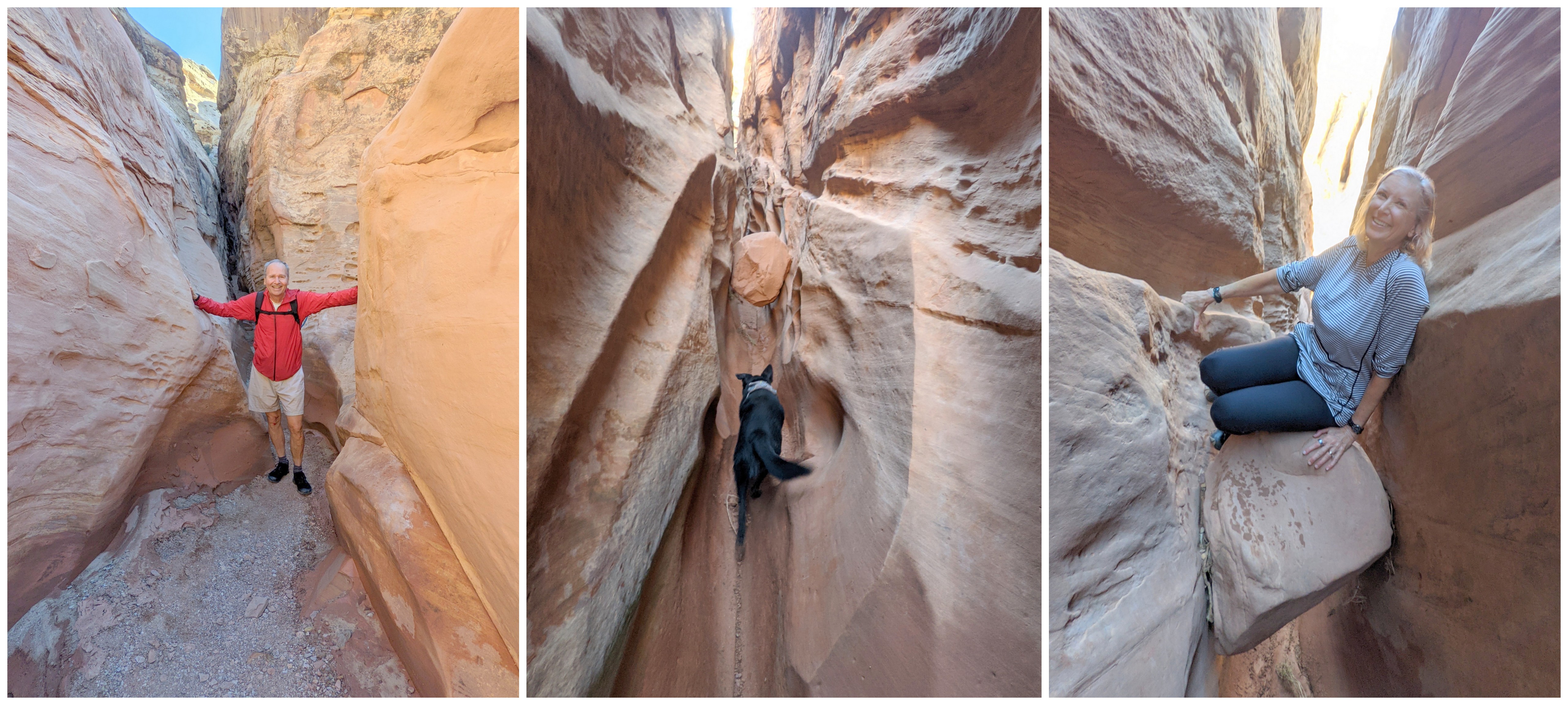
Pre-COVID we hiked at Cathedral Gorge State Park in NV. Very interesting eroded rock layers. Our favorite activity was finding the many hidden passages in the rocks.

Sunset at Cathedral Gorge State Park - on our 32nd Wedding Anniversary
Playing in the hidden slots at Cathedral Gorge

Post COVID: We then spent two night at Snow Canyon State Park in UT, where we hiked on the petrified sand dunes and along the butterfly trail, then down into some lava tubes. These were geologically young tubes - only about 27,000 years old. The white and red sandstone contrast the dark black lava rocks nicely.

At Snow Canyon State Park

More Snow Canyon pics including Elena at the Butterfly Rock and entering a Lava Tube
We next spent a night at the campground in Zion NP. We've been there before and decided to skip the most heavily visited areas. It's like a Disney Park there, with parking lots overflowing and long wait lines for the shuttles. We hiked and bicycled along the trails from our campsite.

From our campsite in Zion NP
The next morning, we drove through the tunnel and planned to do the overlook hike. When we emerged from the tunnel, the parking lot was full and there were cars parked all along the road. We drove past for a mile or two and decided to turn around and try one more time. As we approached the biggest parking lot, a bighorn sheep had come to the edge of the road in the opposite lane. Traffic was stopped, and we turned into the parking area and saw a freshly opened space just for us. Score! The overlook hike is very nice - not too far or steep, with a great view at the end.
From the Zion Overlook

We headed for Kanab where we had a campground at the Best Friends Sanctuary. They are a very big animal rescue group with hundreds of acres of land for the rescued animals to live. Just before we got there, we stopped at the Sand Caves - an old sand mining area high on a cliff. It was quite the rock scramble to make it up there, but we did it.

Sand Caves near Kanab, UT

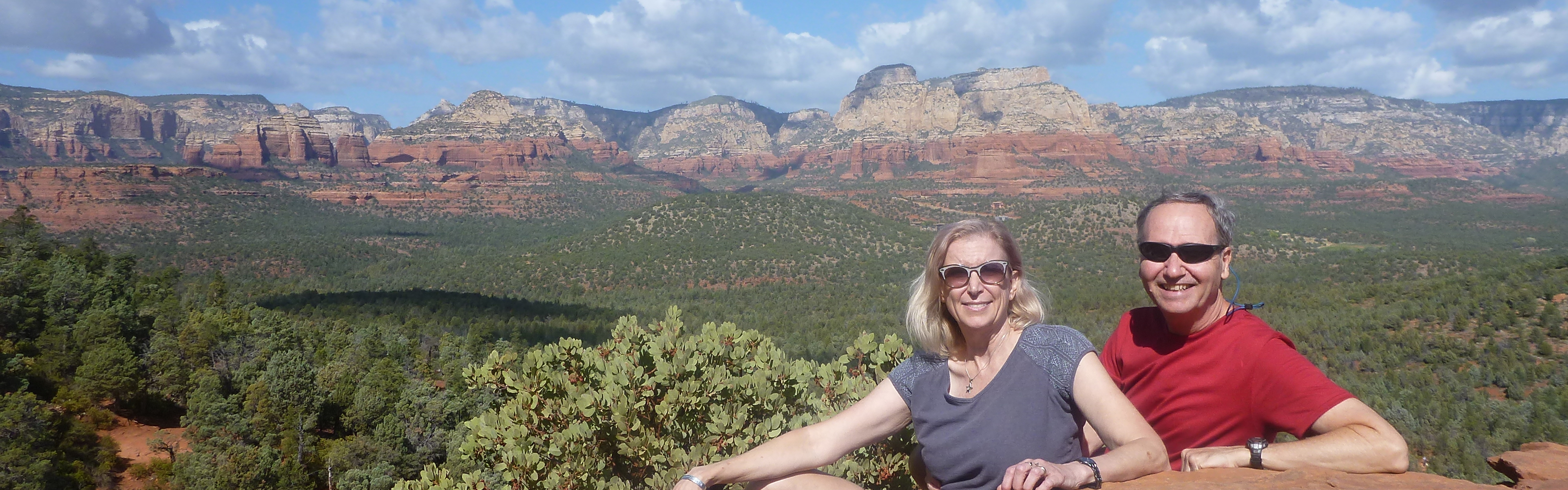
The next few days were planned to be spent hiking Wirepass Slot Canyon, visiting the old Paria town site, and applying for a permit to hike to The Wave. Instead, we lucked into a rim edge campsite at the Grand Canyon North Rim, and we headed that way. We were last at the north rim in 2007, and I took a really cool photo of Elena. We found the spot and recreated the photo and added me this time. The north rim only gets about 10% of the visitation of the south rim, so it's much more enjoyable. There were closing for the season a few days after we left, as they are over 8,000 feet in elevation and can get heavy snow.
2007 Photo of Elena at the Grand Canyon North Rim

2022 Photo of Paul & Elena at the Grand Canyon North Rim
Here are a few more highlights from the north rim of the Grand Canyon.
Grand Canyon North Rim

We headed east toward Page, AZ. On the way, we drove down to the Colorado River at historic Lees Ferry. We hiked around along the beach and watch some raft trips preparing to launch. This is where we launched from in 2013 when we did an 8 day, 277 mile rafting trip all the way through the Grand Canyon. Bebop enjoyed wading in the river.

Lees Ferry near Page, AZ
There are several Antelope Canyon tours around Page, AZ. The Antelope Valley is Navajo land, and there are several places where the wash has cut deep slot canyons in the sandstone. We've toured both Upper and Lower Antelope Canyon before. I paddled through Lake Powell once for many miles to the point where the Antelope Wash enters the lake. This time we took a tour to a section above Upper Antelope Canyon called Canyon X. The name comes from the X you see if you look up as you enter the canyon. It was another beautiful slot canyon and our native guide was excellent. Very knowledgeable and pleasant.
Antelope Canyon X

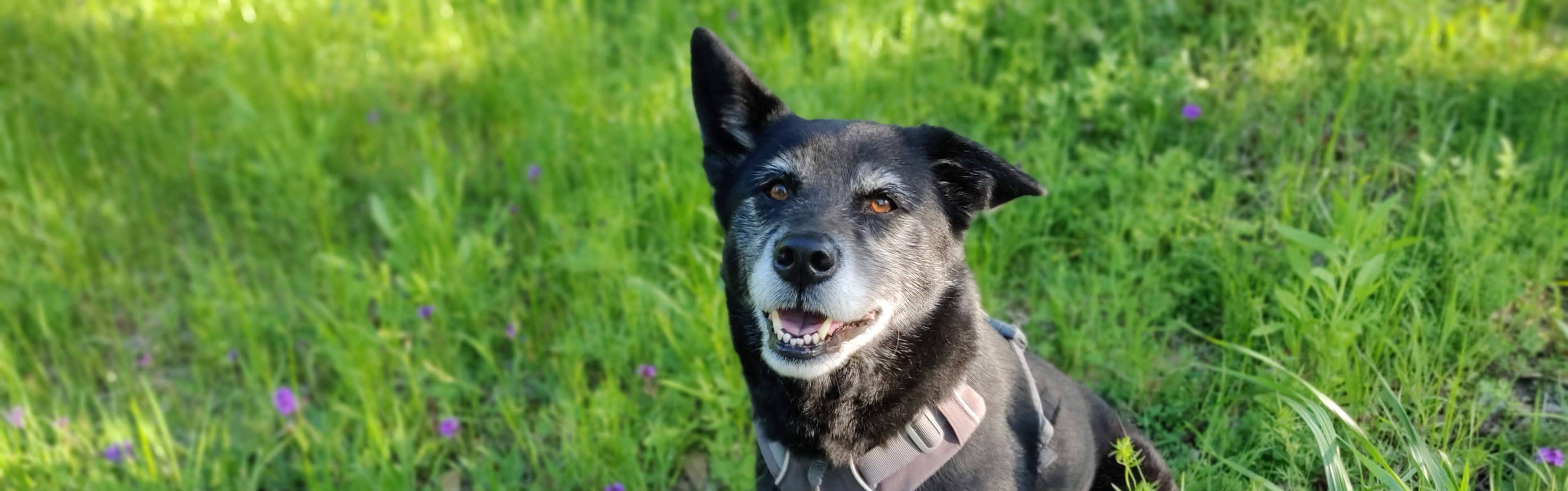
We are in Flagstaff, AZ for the night. COVID has been a wild ride. The first two days were fever, headache, and muscle pain. Then the fever subsided and we were just tired. Then our noses started flowing like fire hoses. Finally, the flow slowed, and now we are mostly just tired by late afternoon. Our modified plans helped us keep enjoying things without overdoing it. And we've been able to isolate ourselves from others by not going indoors anywhere - our camper van is a good quarantine chamber. Bebop is doing fine and has been taking good care of us.

- Paul


Thursday, October 6, 2022

Trying Not to Fall at Kanarra Falls

On day 19 of our road trip, and on our wedding anniversary eve, we decided to try the Kanarra Falls hike. The falls are at the town of Kanarraville, UT just a few minutes north of Zion's Kolob Canyon section.

There are 3 major falls/obstacles along the 4-mile round trip hike, and 650 feet of elevation gain. About half of the hike is in the creek, which is cold spring fed water. Fortunately, the creek is only about ankle deep in most places and with some skilled rock stepping, you can minimize your toe chilling time.

The early part of the trial is dry land with a couple of minor creek crossings. There are a few small, scenic waterfalls along the way.

Creek crossings and small waterfalls along the way

Eventually the canyon narrows, and you are in and out of the creek. The walls narrow into a slot canyon, and you can hear a water fall echoing around the bend. You round a corner and see a 12' high water fall. Many stop here. If you want to continue you used to have to climb a wooden pole ladder, but the town recently installed this aluminum ladder that made it much easier to continue - almost like an escalator it was so easy.

Slot canyon hiking

The former "ladder" (left) and the new fancy ladder (right)

Shortly after the first fall is the Big Boulder. The only way to get over it is to scramble up some wooden poles and sticks that have been piled into the corner. We made it up and over and continued up the stream.

Resting before climbing over Big Boulder
We got to the final waterfall and scrambled up to the top of it. You can continue, but the water becomes deeper and there aren't any more major features ahead.

At the final waterfall

We turned around and headed back down the creek - sometimes down is harder than up. We made it out without incident and back to the van to find Bebop taking a solid nap. What a great hike that was.

- Paul


Tuesday, October 4, 2022

Bebop Reviews Kodachrome Basin & Cedar Breaks

In our last episode my hoomans we were debating about hiking to the Inselberg Pit (Cosmic Navel or Cosmic Volcano) the next morning. They were concerned about the road condition and the weather. I just relaxed and chewed on a stick. At bedtime the night before, the hoomans decided there was too much risk. We woke up the next morning and there were showers and thunderstorms just south of us.Dad said we would have been to the pit about the time a large storm hit there. It was a good call by my hoomans. Also, they let me lick their plates, which is a good call too.

We drove to Kodachrome Basin State Park for a two night stay. It was raining on and off through the day, but that was OK because it was day 16 and the hoomans needed to do laundry - it’s not all glamour on these trips. We dogs have sensitive noses, so I appreciate their effort to stay smelling good. I only have my blanket and towel, so my laundry load is pretty light. There was a nice laundromat right in the campground. It was a scenic laundry location.
Very scenic laundromat
We got a couple of trails done between the rain showers - and then my hoomans took actual showers. Again, we dogs with sensitive noses appreciate that. They had no connectivity, so they couldn't see the storm paths - they had to do it old school by looking to the sky. We dogs know how to read the signs. We don’t use the internet, though it would be great to be able to order some treats and stuff. We hiked the short nature trail and the Angel’s Palace Trail in the afternoon.  Also, I chewed on a stick.
Hiking the trails
 Our campsite was adjacent to a large chimney formation - sort of like the hooman foam #1 finger. The evening brought us some interesting colors and rainbows as the sun peeked through the clouds.
Our campsite
The next morning it was overcast again, but not raining. We hiked the Panorama Trail and had it mostly to ourselves. We didn’t see any other hoomans for over an hour. When we did see other people, they all wanted to pet me and compliment me. I’m very popular with hoomans. They either call me puppy (because of my size, trim figure, and bouncy step), or they call me old girl because of my gray markings. Mom tells them I turned gray to match my dad. They all have a good laugh at that one - except dad. Anyway, it was a nice trail. I got my paws very muddy on a couple of creek channel crossings, and dad even threw some sticks for me. In the photo with the skinny tree and rock you might see me running with a stick. One part was called panorama point, and you could see for miles (or kilometers for all the non US dogs) in every direction.
I'm the leader

Nice hiking - can you find me on the upper right photo?
In the campgrounds and on the trails, there are many dogs, and we met quite a few here. They were mostly very nice, though some get a little too playful and enthusiastic about the butt sniffing part. We do all enjoy sniffing in circles and getting our leashes all twisted together. One little dog was anxiously sitting in the driver's seat of his van looking for his people. I sit in the driver's seat and look too, but I’m much cooler about it. Overall, this was a nice park.

We got up the next morning and it was clear and 38ºF. I already have my coat on, so it was no big deal for me. It was a beautiful day. We decided to skip Bryce Canyon NP for the following reasons: 1. Dogs aren’t allowed on the trails; 2. It was very crowded; 3. My hoomans have been there before; and, once again, 4. Dogs aren’t allowed on the trails. Instead, we stopped at Red Canyon. I don’t know who named this, but it’s not red. I’m a dog with limited color vision, and it was obvious to me it was more orange and pinkish. However, it was very pretty, and we hiked up a big hill. Dad taught me a new word - switchback. I prefer to call them zig-zags. We did several nice hikes in the area.
Red canyon - I'm chewing a stick on the lower right
Finally, we visited Cedar Breaks National Monument. My hoomans said it was prettier than Bryce Canyon and with hardly any people there. It was high too - we were at 10,500 feet above sea level. Most of the stops were near the parking areas, so dogs were allowed to visit. It was indeed very pretty, and I give it two paws up.
Cedar Breaks National Monument
- Bebop

Saturday, October 1, 2022

Grand Staircase Escalante

The Grand Staircase Escalante National Monument, which President Biden recently restored to the original boundaries, is an enormous 1.7 million acres. It was also the last area in the continental US to be mapped in the late 1800s.

We came in from the north side. When we left Capitol Reef NP we headed south on beautiful UT 12. This road climbs to 9,500 feet as it skirts the side of the 11,300' Boulder Mountain. We stayed at Singletree Campground at 8,100 feet one night, then headed toward Boulder, UT. This section of road had scenery that went on forever - even when we were looking into the sun and there were clouds from rain the night before. The aspen trees were already golden in several areas.

Overlook crossing Boulder Mountain in Utah
In addition to the slow climb up the mountain, we were delayed by numerous cows just standing in the road. It's open range, but it's so steep the cattle just follow the road up and down and often stand in it, drinking water from the depressed rumble strip divider. We had to completely stop several times and slow way down many others. 

When we arrived in Boulder, we turned onto the Burr Trail Road and entered the national monument. Highway 12 was beautiful, but Burr Trail Road topped it for scenic beauty. We went in for about 24 of the 30 paved miles, then drove back out - it was stunning in both directions.

Burr Trail through Long Canyon

In Long Canyon

Along Burr Trail
We stopped at singing canyon, which has amazing acoustics. I wish I had brought my saxophone.

Singing Canyon

We intended to hike Lower Calf Creek Falls on our way to Escalante, but another round of monsoon storms started rolling through. Instead, we headed to our campsite at Escalante Petrified Forest State Park. We took their 2-mile hike and saw a lot of petrified wood. The lake next to our campsite was very low, attesting to the drought conditions in the west - and despite the heavy monsoon rains the past couple of days. 

The next morning, we got up early and headed back to Lower Calf Creek. It was clear and 48ºF when we started the hike and clear and 71ºF when we returned about 3.5 hours later. It was a 6.5 mile RT hike to the end of a box canyon where a 130' waterfall spills over.  There was a wild turkey mooching snacks from a couple of other people who were there when we arrived, but it quickly fled when it saw Bebop. We hung out at the falls for about 45 minutes. The entire hike is nice and has only 200' of elevation gain.

Hike to Lower Calf Creek Falls
At  Lower Calf Creek Falls

Then we had to make a decision about the next morning. We really wanted to hike to the Inselberg Pit, which is the largest cylindrical sandstone weathering pit on Earth. It's also called the Cosmic Navel. The hike isn't too bad - about 9 miles and 800' of elevation gain, but the road to the trailhead is a 7-mile gravel/sand road. There is no cell service and our van doesn't have a spare tire. With the chance of rain remaining high, we had extra concerns about trying to make it out there. Our plan was to boondock at the trailhead and hike out early Sunday morning. It's Sat afternoon, and we're still deciding - a flash flood warning just popped up on my phone, but the rain is staying just northeast of us for now. We'll probably save the Inselberg Pit for another day. Here's one of those storms in the distance.
That storm just missed us earlier

- Paul